5 MIN
TRAVEL TIPS
Hiking on Gavdos Island

 Gavdos island has a permanent population since Neolithic times and is thought to be the legendary island home of goddess Calypso who kept shipwrecked Odysseus prisoner for many years with the promise of eternal youth.
There is archaeological evidence that the Roman Empire was active on the island. During this time the flora of the island was overexploited which started a process of erosion visible wherever hiking across the island.
 The locals live mainly in Kastri, a village in the hills of Gavdos, Karave, the port of Gavdos, Ambelos and Vatsiana, the southernmost settlement of the island and Greece.
 We visited Gavdos in mid-September, came by ferry and foot and had no fixed return planned but the desire to discover Gavdos and have authentic experiences. We stayed at Sarakiniko Beach, a dreamy blond sandy beach with crystal clear shallow water, hidden in dunes and a forest of junipers. Flowering thyme bushes were still strong smelling although it was late in the season. Sarakiniko is located just 1.5 km north of Karave and provides some essential amenities: rooms and bungalows for rent, taverns and a mini market. Most people prefer to reach the beach by bus from Karave, but you can also walk about 30 minutes from there.
 Best hiking routes:
Ambelos - Potamos - Pyrgos and back (about three hours)
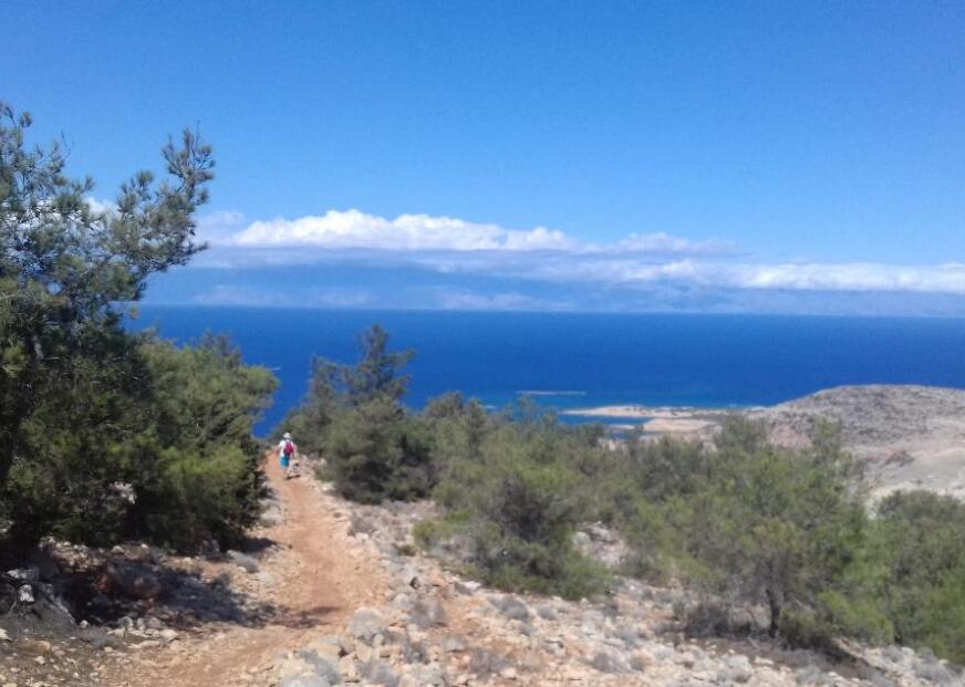
Ambelos is the start of this beautiful hike on the northwest coast of Gavdos, well-marked and suitable even for novice hikers. The village itself consists of a small church, a tiny cemetery, some ruins and a few houses. The path to Potamos and the adjacent beach of Pirgos crosses a dense pine grove and overlooks the islet of Gavdopoula. Potamos is a quite long beach at the exit of a small canyon with majestic geological clay formations and cliffs.
 The path down to Potamos is varied and has shady stretches. Before the final descent, you will have spectacular views on your left-hand side towards the stony shore of Bo cove. We went down to Bo's rocky bottom with the hope to go for a swim in the crystal clear turquoise water but couldn't find anywhere a safe way to get back ashore. It was a frustrating experience as it was still hot, and we had to walk over the hill sweaty to Potamos, but there we got rewarded with a merited picnic rest and fantastic swimming.
 Korfos - Tripiti – Vatsiana (about four hours)
Korfos, a small settlement with a few rooms to let and two taverns is approximately 2km south of Karave. The route runs along the coast for about 4 km providing stunning views and then leads gently down to the site of Tripiti through the peaceful wilderness.
Commonly called Tripiti consists of Tripiti Beach and Cap Tripiti, the southernmost point of Europe and lays at the exit of a dried river. Before reaching the beach, there is a salt pan which dries up in summer but hosts many birds migrating from Europe to Africa in early spring. The beach on the east is sandy, perfect for swimming while the part close to CapTripiti has large stones and pebbles. The Cap itself can be climbed in a couple of minutes and has three arches, called Kamarelles, formed at the eastern corner. Over the Kamarelles there is a giant chair installed, perfect for admiring the vast South Cretan Sea.
 The return to Vatsiana has a few steeper curves at the beginning passing ruins of an abandoned village, then becomes more comfortable and offers fantastic views back to Tripiti and rugged seascapes.
 Sarakiniko - Agios Ioannis - Lavrakas (about three hours)
Lastly, on the easy trail from Sarakiniko to Agios Ioannis and Lavrakas you will meet the tropical side of Gavdos with the long pine- and cedarwooded emerald beaches. Agios Ioannis Beach is protected area under Natura 2000. The path runs through dunes covered with juniper bushes or along the sea leading to the beach of Lavrakas where some campers have turned trees and small rocks combined with constructions made of twigs and cloths into cozy, shady accommodations.
 To See:
Enjoy the spectacular views at sunset from the lighthouse at an altitude of 368 m closed to Ambelos. Built-in 1880 it is no longer in activity as a lighthouse and has turned into a small museum and coffee shop.
Tip:
The sun is intense, even in spring and autumn and there isn’t much shade on the trails and sandy beaches, so come prepared. There are no banks, ATMs or petrol stations. Necessary simple supplies are available in Karave and Sarakiniko.
Have you been to Gavdos or would like to go? Leave me a message: kaleidoventure@yahoo.com
Article by Kaleidoventure


